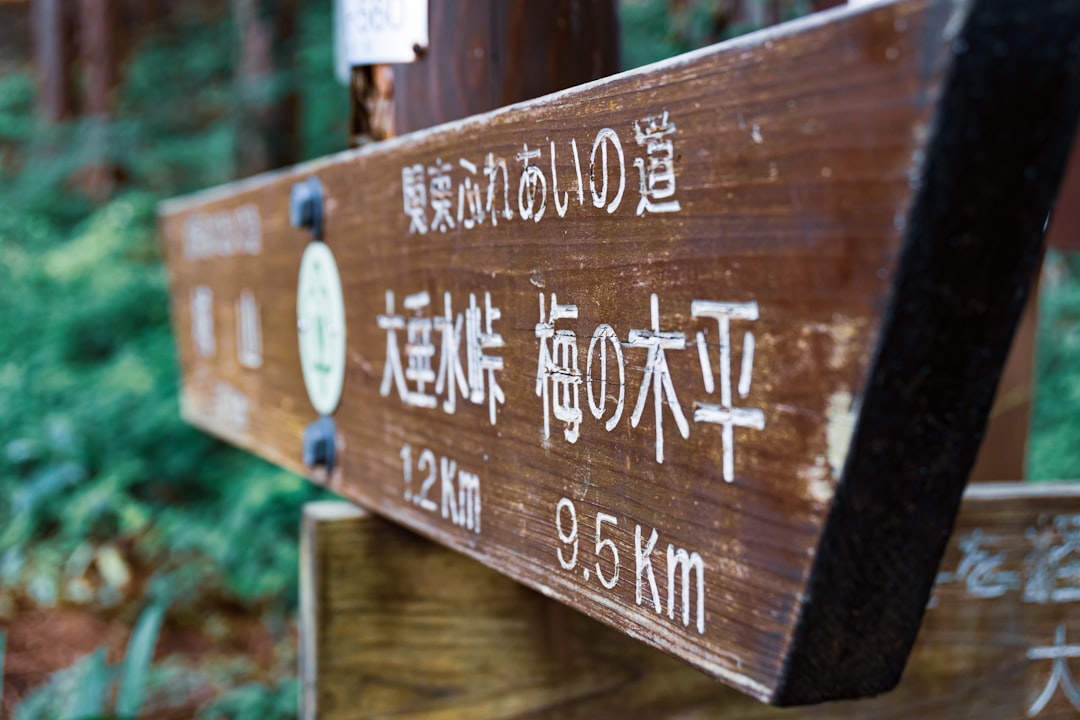

Photo by Se. Tsuchiya on Unsplash
Walking Into Old Japan: The Nakasendo Trail Between Tsumago and Magome
Long before bullet trains sliced across Japan, a network of ancient highways connected Edo (modern Tokyo) with Kyoto. Among these historic routes, the Nakasendo, meaning ‘road through the mountains,’ was the inland alternative to the coastal Tokaido. Today, one section of this centuries-old route remains beautifully preserved and open for travelers to walk in the footsteps of samurai, merchants, and pilgrims: the trail connecting the post towns of Tsumago and Magome in the Kiso Valley.
This hike is consistently ranked among the best short walks in Japan, and for good reason. It offers an accessible, well-marked path through cedar forests, past waterfalls, rice paddies, and traditional wooden buildings, all without requiring technical hiking experience. Whether you have half a day or a full day to spare, this guide will help you plan the perfect Tsumago-Magome adventure.
Why Hike the Tsumago-Magome Nakasendo Trail?
Of the 69 post towns that once lined the Nakasendo, Tsumago and Magome are two of the best-preserved examples remaining. Both towns have banned visible power lines, vending machines, and modern signage in their historic cores, creating an atmosphere that feels genuinely frozen in the Edo period. Walking between them lets you experience not just two charming towns, but the actual mountain path that connected them for hundreds of years.
Unlike many hiking trails in Japan that demand serious fitness or specialized gear, this route is designed for everyday travelers. Families, solo travelers, and older visitors regularly complete it. The path is clearly signed in both Japanese and English, and the surrounding infrastructure, from luggage forwarding services to rest stops, makes it remarkably tourist-friendly.
Trail Basics: Distance, Time, and Difficulty
The full trail between Tsumago and Magome covers approximately 8 kilometers (about 5 miles) and typically takes 3 to 4 hours to walk at a leisurely pace, including stops for photos and rest. The elevation gain is moderate, with the highest point at Magome-toge Pass sitting around 801 meters above sea level.
- Distance: 8 km (5 miles) one way
- Time required: 3-4 hours walking time
- Difficulty: Easy to moderate, suitable for most fitness levels
- Best direction: Magome to Tsumago is slightly easier due to a gentler overall descent
- Trail surface: Mix of paved sections, forest paths, and stone-paved roads
While the trail is manageable for most people, sturdy walking shoes are strongly recommended. Sections of the path involve uneven stone steps, tree roots, and occasionally muddy patches after rain.
Which Direction Should You Walk?
Most hikers choose to start in Magome and walk to Tsumago. This direction offers a gentler overall gradient, since you climb steadily out of Magome to the pass and then descend more gradually into Tsumago. Starting in Magome also means you tackle the steepest uphill section early when your energy levels are highest.
That said, walking from Tsumago to Magome is equally valid and offers different views, particularly of the valley opening up as you approach Magome. Neither direction is objectively better; it largely comes down to personal preference and transportation logistics for your itinerary.
Getting to the Trailheads
Both towns are located in the Kiso Valley in Nagano Prefecture, accessible via the JR Chuo Line. The nearest train stations are Nagiso Station for Tsumago and Nakatsugawa Station for Magome, though Magome itself does not have its own train station and requires a short bus ride from Nakatsugawa.
Many travelers base themselves in nearby cities like Nagoya or Matsumoto and make a day trip to hike the trail. Local buses connect Nagiso Station to Tsumago, and a separate bus service runs between Nakatsugawa Station and Magome. Taxis are also available but less commonly used given the reliable bus connections.
What You Will See Along the Way
Traditional Post Towns
Tsumago is often considered the more atmospheric of the two towns, with an entire street of wooden merchant houses, ryokan inns, and shops preserved in Edo-period style. Magome, rebuilt after a fire, features a steep, cobblestone main street lined with similar wooden architecture, offering excellent views over the valley below.
Forest Paths and Waterfalls
Between the towns, the trail winds through dense cedar and cypress forests that feel worlds away from urban Japan. A highlight for many hikers is Odaki and Medaki, a pair of waterfalls located a short detour from the main path, named ‘male falls’ and ‘female falls’ respectively.
Bear Bells and Wildlife Awareness
One quirky and memorable feature of this hike is the presence of bear bells at various points along the trail. Black bears do inhabit the surrounding forests, though encounters with hikers are extremely rare. Ringing the bells as you walk through denser wooded sections is a traditional precaution that adds a small thrill to the journey.
Historic Teahouses and Rest Stops
Near the midpoint of the trail, around Magome-toge Pass, you will find a rest hut where volunteers sometimes offer free tea to passing hikers. This is a wonderful spot to rest, chat with fellow travelers, and soak in the mountain scenery before continuing your journey.
Practical Tips for a Smooth Hike
- Luggage forwarding: Both towns offer a same-day luggage transport service for a small fee, allowing you to hike with just a small day pack while your main bags are sent ahead to your next destination.
- Timing: Start your hike by mid-morning at the latest to ensure you finish with daylight to spare, especially in the shorter days of late autumn and winter.
- Water and snacks: While there are rest stops, it is wise to carry your own water and light snacks, as options along the trail itself are limited.
- Weather preparation: The trail passes through forested and open areas, so check the forecast and bring a light rain jacket if needed. Sections can become slippery after rainfall.
- Trail markers: Signage is generally excellent, with distance markers and directional signs in English, but downloading an offline map as backup is a good precaution.
Best Time of Year to Hike
The Tsumago-Magome trail is a genuinely year-round destination, with each season offering something distinct. Spring brings fresh greenery and mild temperatures, ideal for comfortable walking. Summer offers lush forest canopy providing shade, though humidity can make the uphill sections feel more strenuous. Autumn transforms the surrounding hillsides with vibrant foliage, making it one of the most popular times to visit. Winter is quieter, colder, and occasionally snowy, but the crisp air and near-empty trail appeal to those seeking solitude, provided you come prepared with appropriate footwear for potentially icy patches.
Making the Most of Your Visit
While the hike itself can be completed in half a day, many travelers choose to spend a night in Tsumago at a traditional ryokan to fully absorb the historic atmosphere once the day-trip crowds have departed. Staying overnight allows you to wander the quiet streets in early morning or evening light, when the town feels most authentic.
If time allows, consider extending your trip to explore other parts of the Kiso Valley, such as the post towns of Narai or Tsumago’s lesser-visited neighbors, which offer similar charm with fewer visitors.
Final Thoughts
The Tsumago-Magome Nakasendo trail hike represents one of the most rewarding half-day experiences available to travelers in Japan. It combines manageable physical activity, rich historical context, and genuinely beautiful scenery in a package accessible to nearly anyone. Whether you are a dedicated hiker seeking a gentle introduction to Japan’s mountain trails or a history enthusiast wanting to walk an authentic piece of the old Nakasendo highway, this route delivers an unforgettable day in the Kiso Valley.